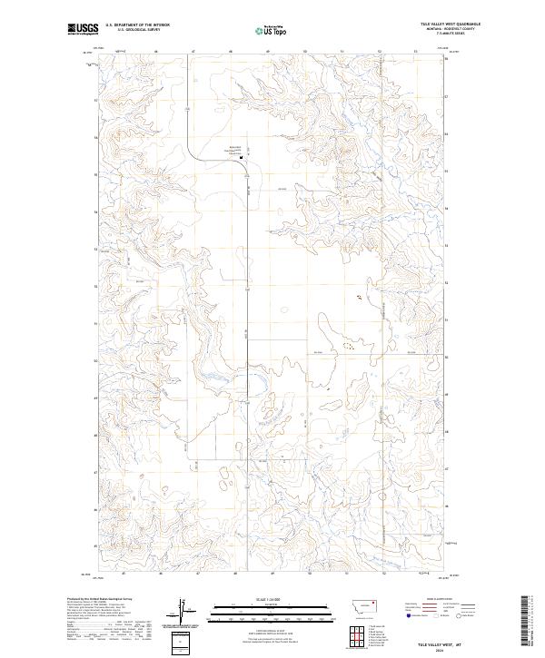
2024 Map of Tule Valley West
USGS Topo · Published 2024About this map
The Bethel Wolf Point Mennonite Church Cem serves as a significant cultural anchor in this corner of Roosevelt County, positioned at the junction of Mc 1 Dr and Volt Rd. The landscape is defined by the drainage of Tule Creek and the West Fork Tule Creek, which carve out the broad Tule Valley across the eastern half of the map. This modern survey reflects the enduring section-line road network typical of the Montana plains, where names like Powder River Rd and Rd 1077 trace the boundaries of rural land tracts. The terrain transitions from flat prairie plateaus to more complex coulees and ridges as the elevation drops toward the creek beds, illustrating the traditional ranching and agricultural patterns of the High Plains.
Find a feature on this map
23 named features on this map. Tap any name to fly to it.
Don’t see what you’re looking for? This feature index may not catch every label — zoom into the map to look around manually.
Map Details
Editions of this 2024 Tule Valley West Map
This is the sole edition of this map. No revisions or reprints were ever made.
Other maps of this area

1910 · Todd Lakes
USGS Topo · 1:62,500

1915 · Tule Valley
USGS Topo · 1:62,500

1915 · Oswego
USGS Topo · 1:62,500

1915 · Todd Lakes
USGS Topo · 1:62,500

1916 · Wolf Point
USGS Topo · 1:62,500

1954 · Wolf Point
USGS Topo · 1:250,000

1958 · Wolf Point
USGS Topo · 1:250,000

1972 · Flynn Creek North
USGS Topo · 1:24,000
1972 · Wolf Point NE
USGS Topo · 1:24,000
1972 · Wolf Point NW
USGS Topo · 1:24,000