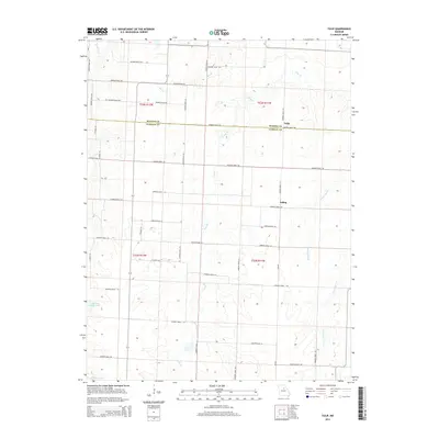
2014 Map of Tulip
USGS Topo · Published 2014About this map
Tulip and Saling sit within a landscape defined by the drainage networks of north-central Missouri, straddling the boundary between Monroe and Audrain counties. The area is characterized by an extensive grid of section-line roads, including Monroe Road 900 and Audrain Road 148, which connect isolated homesteads across the townships. Water resources are prominent throughout the quadrangle, with Reese Fork cutting through the northwest corner and the headwaters of Scattering Branch and Goodwater Creek emerging in the south. This 2014 survey documents the persistence of small rural settlements and large agricultural tracts, such as those surrounding Cedarlane Farms Lake and Larrabee Lake. The map provides a clear look at the modern rural infrastructure, showing the relationship between local thoroughfares and the natural creek beds like Bee Branch and Long Branch.
Find a feature on this map
45 named features on this map. Tap any name to fly to it.
Don’t see what you’re looking for? This feature index may not catch every label — zoom into the map to look around manually.
Map Details
Editions of this 2014 Tulip Map
This is the sole edition of this map. No revisions or reprints were ever made.
Other maps of this area

1890 · Moberly
USGS Topo · 1:125,000

1917 · Sturgeon
USGS Topo · 1:62,500

1945 · Centralia
USGS Topo · 1:62,500

1952 · Middle Grove
USGS Topo · 1:24,000

1953 · Moberly
USGS Topo · 1:250,000

1953 · Clark
USGS Topo · 1:24,000

1954 · Moberly
USGS Topo · 1:250,000

1957 · Moberly
USGS Topo · 1:250,000

1958 · Tulip
USGS Topo · 1:24,000
1959 · Madison
USGS Topo · 1:24,000