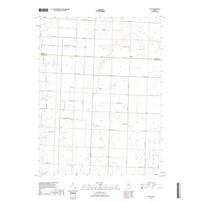
2017 Map of Tulip
USGS Topo · Published 2017About this map
Tulip sits at the junction of the Monroe and Audrain county line, serving as a central point in this rural landscape defined by agricultural drainage systems and managed water resources. The terrain is structured by the headwaters of several streams, including Bee Br, Long Br, and the winding Scattering Br, which move through the rolling northern Missouri countryside. Managed water bodies like Cedarlane Farms Lake and Larrabee Lake indicate the local importance of land and water management for farming operations. A dense network of county and secondary roads, such as State Hwy M and State Hwy EE, connects the dispersed farmsteads, reflecting a persistent 21st-century settlement pattern that still follows the established township and range grids of the Midwest.
Find a feature on this map
50 named features on this map. Tap any name to fly to it.
Don’t see what you’re looking for? This feature index may not catch every label — zoom into the map to look around manually.
Map Details
Editions of this 2017 Tulip Map
This is the sole edition of this map. No revisions or reprints were ever made.
Other maps of this area

1890 · Moberly
USGS Topo · 1:125,000

1917 · Sturgeon
USGS Topo · 1:62,500

1945 · Centralia
USGS Topo · 1:62,500

1952 · Middle Grove
USGS Topo · 1:24,000

1953 · Moberly
USGS Topo · 1:250,000

1953 · Clark
USGS Topo · 1:24,000

1954 · Moberly
USGS Topo · 1:250,000

1957 · Moberly
USGS Topo · 1:250,000

1958 · Tulip
USGS Topo · 1:24,000
1959 · Madison
USGS Topo · 1:24,000