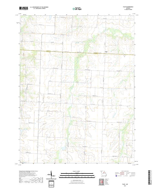
2021 Map of Tulip
USGS Topo · Published 2021About this map
Tulip sits along the border of Monroe and Audrain counties, representing a quiet agricultural landscape in northeast Missouri. This 2021 survey illustrates a region defined by its drainage networks, where Reese Fork and Bee Br feed into a larger system of creeks and branches. The terrain is structured by a grid of named county roads, such as Audrain Road 156 and State Hwy EE, which connect scattered farmsteads across the undulating prairie.
Find a feature on this map
31 named features on this map. Tap any name to fly to it.
Don’t see what you’re looking for? This feature index may not catch every label — zoom into the map to look around manually.
Map Details
Editions of this 2021 Tulip Map
This is the sole edition of this map. No revisions or reprints were ever made.
Other maps of this area

1890 · Moberly
USGS Topo · 1:125,000

1917 · Sturgeon
USGS Topo · 1:62,500

1945 · Centralia
USGS Topo · 1:62,500

1952 · Middle Grove
USGS Topo · 1:24,000

1953 · Moberly
USGS Topo · 1:250,000

1953 · Clark
USGS Topo · 1:24,000

1954 · Moberly
USGS Topo · 1:250,000

1957 · Moberly
USGS Topo · 1:250,000

1958 · Tulip
USGS Topo · 1:24,000
1959 · Madison
USGS Topo · 1:24,000