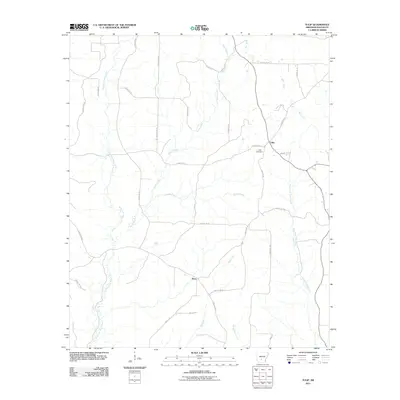
2011 Map of Tulip
USGS Topo · Published 2011About this map
The settlement of Tulip and the surrounding timberlands of Dallas County are defined by the convergence of the West Fork Tulip Creek and East Fork Tulip Creek. During this era of the early 21st century, the landscape is crisscrossed by a dense network of timber and county roads, such as County Rd-69 and County Rd-381, serving the rural communities of Wave and Tulip. The terrain is deeply etched by a complex drainage system, including Smith Creek, Hall Creek, and Moro Creek, which underscores the importance of local hydrology to the area's development. Genealogists will find the Tulip Cemetery particularly noteworthy, as it serves as a central landmark for the historic community. The presence of Copeland Trl and various Dallas County routes illustrates the persistent connectivity within this wooded Arkansas interior.
Find a feature on this map
33 named features on this map. Tap any name to fly to it.
Don’t see what you’re looking for? This feature index may not catch every label — zoom into the map to look around manually.
Map Details
Editions of this 2011 Tulip Map
This is the sole edition of this map. No revisions or reprints were ever made.
Other maps of this area

1903 · Camden
USGS Topo · 1:125,000

1953 · El Dorado
USGS Topo · 1:250,000

1955 · Little Rock
USGS Topo · 1:250,000

1956 · Little Rock
USGS Topo · 1:250,000

1957 · El Dorado
USGS Topo · 1:250,000

1958 · El Dorado
USGS Topo · 1:250,000

1960 · El Dorado
USGS Topo · 1:250,000

1960 · Little Rock
USGS Topo · 1:250,000

1964 · Little Rock
USGS Topo · 1:250,000

1965 · Round Hill
USGS Topo · 1:24,000