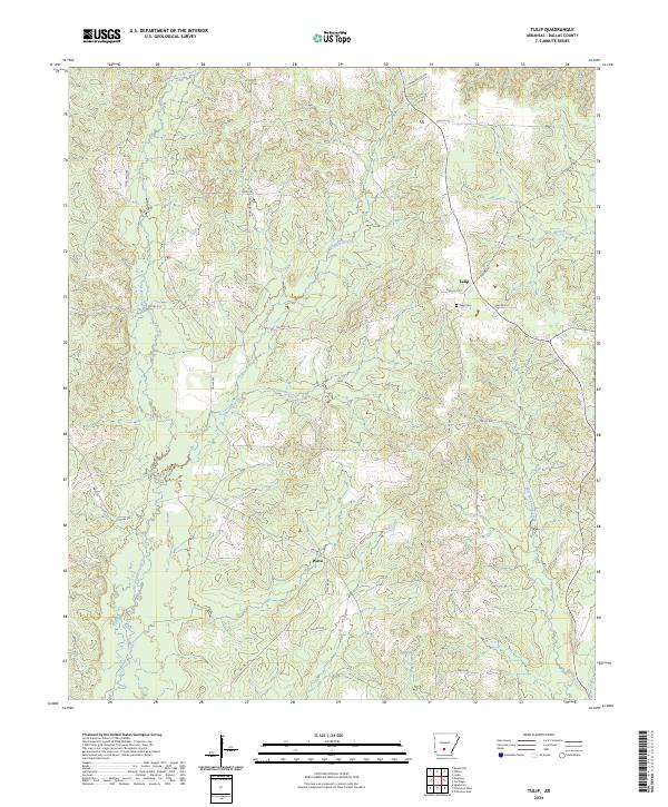
2024 Map of Tulip
USGS Topo · Published 2024About this map
Tulip and the surrounding timberlands of Dallas County are defined by a network of dendritic waterways that feed the Ouachita River basin. This landscape is dominated by the confluence of the West Fork Tulip Creek and East Fork Tulip Creek, which dictate the local road patterns and land use. The small settlement at Tulip is the primary focal point of the quadrangle, anchored by the Tulip Cem.
Find a feature on this map
31 named features on this map. Tap any name to fly to it.
Don’t see what you’re looking for? This feature index may not catch every label — zoom into the map to look around manually.
Map Details
Editions of this 2024 Tulip Map
This is the sole edition of this map. No revisions or reprints were ever made.
Other maps of this area

1903 · Camden
USGS Topo · 1:125,000

1953 · El Dorado
USGS Topo · 1:250,000

1955 · Little Rock
USGS Topo · 1:250,000

1956 · Little Rock
USGS Topo · 1:250,000

1957 · El Dorado
USGS Topo · 1:250,000

1958 · El Dorado
USGS Topo · 1:250,000

1960 · El Dorado
USGS Topo · 1:250,000

1960 · Little Rock
USGS Topo · 1:250,000

1964 · Little Rock
USGS Topo · 1:250,000

1965 · Round Hill
USGS Topo · 1:24,000