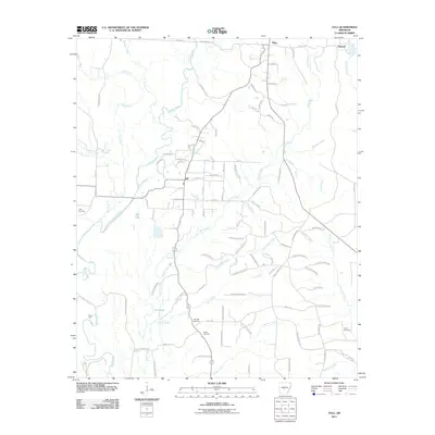
2011 Map of Tull
USGS Topo · Published 2011About this map
The Saline River winds through this central Arkansas landscape, defining a terrain shaped by its numerous tributaries and established rural settlements. Near the center of the sheet, Tull serves as a local hub, situated just east of Tull Lake and north of the smaller Nall Lake. The map details a transition from the structured residential grid of Tull—with streets like E Cherry St and Walnut St—to the surrounding timberlands and creek bottoms.
Find a feature on this map
102 named features on this map. Tap any name to fly to it.
Don’t see what you’re looking for? This feature index may not catch every label — zoom into the map to look around manually.
Map Details
Editions of this 2011 Tull Map
This is the sole edition of this map. No revisions or reprints were ever made.
Other maps of this area

1890 · Benton
USGS Topo · 1:125,000

1891 · Little Rock
USGS Topo · 1:125,000

1893 · Little Rock
USGS Topo · 1:125,000

1894 · Benton
USGS Topo · 1:125,000

1935 · Alexander
USGS Topo · 1:48,000

1938 · Benton
USGS Topo · 1:48,000

1941 · Alexander
USGS Topo · 1:62,500

1944 · Benton
USGS Topo · 1:62,500

1944 · Bryant
USGS Topo · 1:31,680

1944 · Benton
USGS Topo · 1:31,680