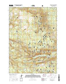
2017 Map of Tumalo Falls
USGS Topo · Published 2017About this map
Tumalo Falls stands as a central landmark within this portion of the Deschutes National Forest, where the hydrology of the Cascade Range creates a complex network of springs and creeks. The landscape is defined by significant elevation changes, from the heights of the Tam McArthur Rim to the basin containing Tumalo Lake. Evidence of a robust recreational and forest management infrastructure is visible through an extensive system of named trails and roads, including the Metolius-Windigo and the Tam McArthur Rim Horse Trail. High-altitude meadows and water sources like Happy Valley, Farewell Spring, and Jack Pine Spring suggest a terrain traditionally utilized for both its natural resources and seasonal passage. The concentration of winter-specific routes, such as the Tumalo Creek Nordic Loop and Snomo #8, highlights the area's modern identity as a hub for backcountry exploration and outdoor activity.
Find a feature on this map
70 named features on this map. Tap any name to fly to it.
Don’t see what you’re looking for? This feature index may not catch every label — zoom into the map to look around manually.
Map Details
Editions of this 2017 Tumalo Falls Map
This is the sole edition of this map. No revisions or reprints were ever made.
Other maps of this area

1926 · Bend
USGS Topo · 1:125,000

1929 · Bend
USGS Topo · 1:125,000

1929 · Three Sisters
USGS Topo · 1:125,000

1930 · Maiden Peak
USGS Topo · 1:125,000

1931 · Newberry Crater
USGS Topo · 1:125,000

1932 · Three Sisters
USGS Topo · 1:125,000

1934 · Maiden Peak
USGS Topo · 1:125,000

1935 · Newberry Crater
USGS Topo · 1:125,000

1955 · Crescent
USGS Topo · 1:250,000

1955 · Bend
USGS Topo · 1:250,000