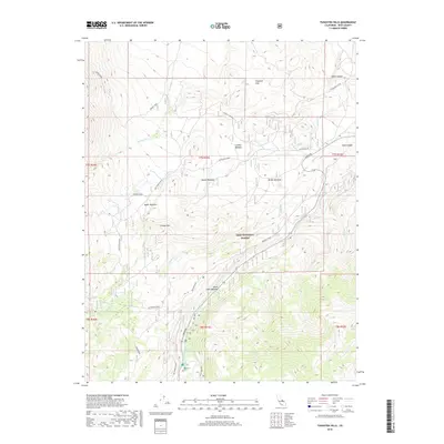
2018 Map of Tungsten Hills
USGS Topo · Published 2018About this map
Tungsten Hills rises sharply above the high desert floor, dominating this 2018 survey of the Sierra Nevada foothills west of Bishop. The landscape is defined by an intricate network of alpine drainage systems, including Horton Cr and McGee Cr, which feed into the larger Bishop Cr system. Historical land use in the Inyo National Forest is evidenced by the numerous named high-altitude clearings like Dutch Johns Meadow, Sharps Meadow, and McGee Meadow. These meadows, often situated near vital water sources, indicate the region's importance for early summer grazing and transit. At higher elevations, the terrain culminates at Grouse Mtn, overlooking the remote Horton Lakes. The presence of Tungsten City Rd serves as a modern connection to the area's mining heritage, while recreation points like Moraine Picnic demonstrate contemporary use of the forest lands.
Find a feature on this map
31 named features on this map. Tap any name to fly to it.
Don’t see what you’re looking for? This feature index may not catch every label — zoom into the map to look around manually.
Map Details
Editions of this 2018 Tungsten Hills Map
This is the sole edition of this map. No revisions or reprints were ever made.
Other maps of this area

1912 · Mt. Goddard
USGS Topo · 1:125,000

1913 · Bishop
USGS Topo · 1:125,000

1947 · Mariposa
USGS Topo · 1:250,000

1948 · Mariposa
USGS Topo · 1:250,000

1948 · Mt. Goddard
USGS Topo · 1:62,500

1949 · Mt. Tom
USGS Topo · 1:62,500

1949 · Bishop
USGS Topo · 1:62,500

1950 · Big Pine
USGS Topo · 1:62,500

1951 · Mt. Tom
USGS Topo · 1:62,500

1951 · Mt. Goddard
USGS Topo · 1:62,500