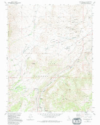
1990 Map of Tungsten Hills
USGS Topo · Published 1995About this map
Mining operations and recreation intersect in the Tungsten Hills region of Inyo National Forest on this 1990 survey. The landscape is defined by its industrial history, specifically a cluster of mines in the northern canyons including the Aeroplane Mine, Tungsten Blue Mine, and White Caps Mine. These sites sit alongside a complex system of infrastructure, including a Tailings Pond and several aqueducts and penstocks that channel water from sources like Bishop Creek.
Find a feature on this map
39 named features on this map. Tap any name to fly to it.
Don’t see what you’re looking for? This feature index may not catch every label — zoom into the map to look around manually.
Map Details
Editions of this 1990 Tungsten Hills Map
This is the sole edition of this map. No revisions or reprints were ever made.
Other maps of this area

1912 · Mt. Goddard
USGS Topo · 1:125,000

1913 · Bishop
USGS Topo · 1:125,000

1947 · Mariposa
USGS Topo · 1:250,000

1948 · Mariposa
USGS Topo · 1:250,000

1948 · Mt. Goddard
USGS Topo · 1:62,500

1949 · Mt. Tom
USGS Topo · 1:62,500

1949 · Bishop
USGS Topo · 1:62,500

1950 · Big Pine
USGS Topo · 1:62,500

1951 · Mt. Tom
USGS Topo · 1:62,500

1951 · Mt. Goddard
USGS Topo · 1:62,500