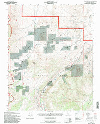
1994 Map of Tungsten Hills
USGS Topo · Published 1997About this map
Tungsten Hills rise in this 1990s U.S. Forest Service revision, characterized by a concentration of legacy mining operations northeast of Bishop Creek. The landscape is a complex network of extraction sites including the Jackrabbit Mine, Lucky Strike Mine, and the Aeroplane Mine, all connected by winding unimproved roads. The southwestern portion of the map transitions into the high-altitude terrain of the Inyo National Forest and the edge of the John Muir Wilderness. This era of mapping shows the sophisticated water management infrastructure of the eastern Sierra, with the Bishop Creek Aqueduct and numerous penstocks following the descent from McGee Meadow and Dutch Johns Meadow. These features, alongside the Sewer Treatment Plant, indicate the industrial and municipal utilization of the region's sharp elevation drops.
Find a feature on this map
40 named features on this map. Tap any name to fly to it.
Don’t see what you’re looking for? This feature index may not catch every label — zoom into the map to look around manually.
Map Details
Editions of this 1994 Tungsten Hills Map
This is the sole edition of this map. No revisions or reprints were ever made.
Other maps of this area

1912 · Mt. Goddard
USGS Topo · 1:125,000

1913 · Bishop
USGS Topo · 1:125,000

1947 · Mariposa
USGS Topo · 1:250,000

1948 · Mariposa
USGS Topo · 1:250,000

1948 · Mt. Goddard
USGS Topo · 1:62,500

1949 · Mt. Tom
USGS Topo · 1:62,500

1949 · Bishop
USGS Topo · 1:62,500

1950 · Big Pine
USGS Topo · 1:62,500

1951 · Mt. Tom
USGS Topo · 1:62,500

1951 · Mt. Goddard
USGS Topo · 1:62,500