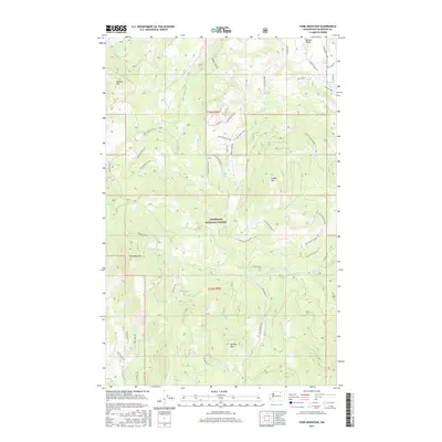
2017 Map of Tunk Mountain
USGS Topo · Published 2017About this map
Tunk Mountain and the high ridges of the Okanogan National Forest dominate this high-altitude landscape in northern Washington. The terrain is defined by a series of prominent peaks, including Aeneas Mtn, Bannon Mtn, and Sneed Mtn, with narrow valleys carved by Aeneas Cr and Patterson Cr. The settlement pattern is sparse, concentrated primarily along Aeneas Valley Rd in the northeast, where the Aeneas Valley provides a break in the timbered slopes. The map details an extensive network of forest development roads and historic pathways, such as the Stage Coach Trl and Long Horn Trl, which speak to the area's history of movement through the mountain passes. Water sources are critical landmarks in this environment, ranging from Round Lake and Long Lake to high-elevation points like Pine Needle Spr and Aeneas Spring.
Find a feature on this map
48 named features on this map. Tap any name to fly to it.
Don’t see what you’re looking for? This feature index may not catch every label — zoom into the map to look around manually.
Map Details
Editions of this 2017 Tunk Mountain Map
This is the sole edition of this map. No revisions or reprints were ever made.
Other maps of this area

1902 · Osoyoos
USGS Topo · 1:125,000

1904 · Osoyoos
USGS Topo · 1:125,000

1952 · Disautel
USGS Topo · 1:62,500

1953 · Omak Lake
USGS Topo · 1:62,500

1954 · Okanogan
USGS Topo · 1:250,000

1957 · Tonasket
USGS Topo · 1:62,500

1957 · Aeneas Valley
USGS Topo · 1:62,500

1958 · Okanogan
USGS Topo · 1:250,000
1980 · Omak Mountain
USGS Topo · 1:24,000
1981 · Barker Mtn
USGS Topo · 1:24,000