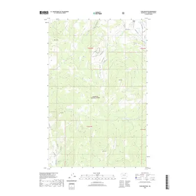
2020 Map of Tunk Mountain
USGS Topo · Published 2020About this map
Tunk Mtn and Bannon Mtn dominate the northern Okanogan high country, where the Okanogan National Forest meets the scattered settlements of Aeneas Valley. This landscape is defined by its complex network of seasonal drainages and springs, including the headwaters of Aeneas Cr and Patterson Cr. The map reveals a transition from the peaks to the flatter benches of the northeast, where several natural water bodies like Gooseberry Lake and Long Lake are situated near Aeneas Valley Rd. The human presence is traced through an extensive system of forest roads and historic routes, such as the Stage Coach Trl and Lone Pine Trl in the south, indicating a long history of travel through these mountain passes. Local place names like Jacks Pass and Snowbunny Ridge Dr suggest a land utilized for both timber management and recreation in the early twenty-first century.
Find a feature on this map
41 named features on this map. Tap any name to fly to it.
Don’t see what you’re looking for? This feature index may not catch every label — zoom into the map to look around manually.
Map Details
Editions of this 2020 Tunk Mountain Map
This is the sole edition of this map. No revisions or reprints were ever made.
Other maps of this area

1902 · Osoyoos
USGS Topo · 1:125,000

1904 · Osoyoos
USGS Topo · 1:125,000

1952 · Disautel
USGS Topo · 1:62,500

1953 · Omak Lake
USGS Topo · 1:62,500

1954 · Okanogan
USGS Topo · 1:250,000

1957 · Tonasket
USGS Topo · 1:62,500

1957 · Aeneas Valley
USGS Topo · 1:62,500

1958 · Okanogan
USGS Topo · 1:250,000
1980 · Omak Mountain
USGS Topo · 1:24,000
1981 · Barker Mtn
USGS Topo · 1:24,000