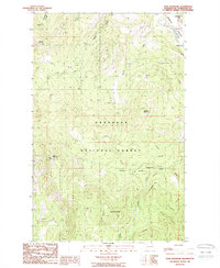
1988 Map of Tunk Mountain
USGS Topo · Published 1988About this map
Okanogan National Forest dominates this topographic study of the high country in northern Washington, centered on the prominent summit of Tunk Mountain. A key landmark for regional surveillance, the Tunk Mountain Lookout Tower stands atop the peak, overlooking a landscape defined by sharp elevation shifts and narrow valleys. To the northeast, the Aeneas Valley provides a lower-lying corridor containing a string of small water bodies, including Gooseberry Lake, Long Lake, and Round Lake. The map details the drainage patterns of the area, where several water sources like Patterson Creek and Peony Creek flow from the slopes of Bannon Mountain and Sneed Mountain. Scattered Gravel Pits indicate localized resource extraction, while numerous springs, such as Aeneas Spring, highlight the critical water points in this high-altitude environment.
Find a feature on this map
20 named features on this map. Tap any name to fly to it.
Don’t see what you’re looking for? This feature index may not catch every label — zoom into the map to look around manually.
Map Details
Editions of this 1988 Tunk Mountain Map
This is the sole edition of this map. No revisions or reprints were ever made.
Other maps of this area

1902 · Osoyoos
USGS Topo · 1:125,000

1904 · Osoyoos
USGS Topo · 1:125,000

1952 · Disautel
USGS Topo · 1:62,500

1953 · Omak Lake
USGS Topo · 1:62,500

1954 · Okanogan
USGS Topo · 1:250,000

1957 · Tonasket
USGS Topo · 1:62,500

1957 · Aeneas Valley
USGS Topo · 1:62,500

1958 · Okanogan
USGS Topo · 1:250,000
1980 · Omak Mountain
USGS Topo · 1:24,000
1981 · Barker Mtn
USGS Topo · 1:24,000