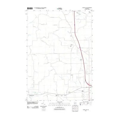
2010 Map of Tunnel City
USGS Topo · Published 2010About this map
Tunnel City serves as a focal point in this Monroe County landscape, situated near the headwaters of Sparta Creek and the southern edge of the survey. The geography is defined by a network of drainage systems, including the southward-flowing Mud Creek and the La Crosse River in the northwest corner. This area demonstrates a high density of rural burial grounds, with Saint Marys Cemetery, Greenfield Cemetery, and Boyonton Cemetery clustered near the southern settlements, while the Warren Mills Cemetery sits at the northern edge along Whisky Creek.
Find a feature on this map
62 named features on this map. Tap any name to fly to it.
Don’t see what you’re looking for? This feature index may not catch every label — zoom into the map to look around manually.
Map Details
Editions of this 2010 Tunnel City Map
This is the sole edition of this map. No revisions or reprints were ever made.
Other maps of this area

1916 · Tomah
USGS Topo · 1:62,500

1919 · Kendall
USGS Topo · 1:62,500

1921 · Kendall
USGS Topo · 1:62,500

1947 · Millston
USGS Topo · 1:62,500

1949 · Millston
USGS Topo · 1:62,500

1949 · Tomah
USGS Topo · 1:62,500

1953 · Eau Claire
USGS Topo · 1:250,000

1958 · Eau Claire
USGS Topo · 1:250,000

1958 · Wyeville
USGS Topo · 1:48,000

1958 · La Crosse
USGS Topo · 1:250,000