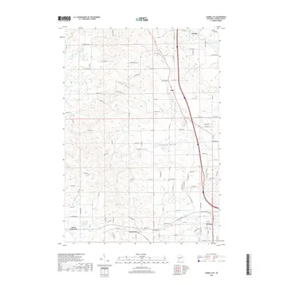
2018 Map of Tunnel City
USGS Topo · Published 2018About this map
Tomah anchors the southeastern corner of this Monroe County landscape, where the headwaters of the La Crosse River begin their westward journey. The terrain is defined by a series of distinct valleys, including Summit Valley, Union Valley, and Pleasant Valley, which channeled early roads and settlements. Near Warrens, the Warren Mills Cem serves as a reminder of the area's pioneer generations. The map reveals a dense network of local routes such as Bittersweet Ave and Blackhawk Ave that weave through the undulating geography. Local heritage is deeply rooted in these small communities and burial grounds, with Tunnel City positioned near the confluence of Sparta Cr and Tarr Cr. Further south, the recreation areas around Spring Bank Park and Flora Dell Lake illustrate how the natural water systems have been utilized for community spaces alongside traditional agriculture.
Find a feature on this map
108 named features on this map. Tap any name to fly to it.
Don’t see what you’re looking for? This feature index may not catch every label — zoom into the map to look around manually.
Map Details
Editions of this 2018 Tunnel City Map
This is the sole edition of this map. No revisions or reprints were ever made.
Other maps of this area

1916 · Tomah
USGS Topo · 1:62,500

1919 · Kendall
USGS Topo · 1:62,500

1921 · Kendall
USGS Topo · 1:62,500

1947 · Millston
USGS Topo · 1:62,500

1949 · Millston
USGS Topo · 1:62,500

1949 · Tomah
USGS Topo · 1:62,500

1953 · Eau Claire
USGS Topo · 1:250,000

1958 · Eau Claire
USGS Topo · 1:250,000

1958 · Wyeville
USGS Topo · 1:48,000

1958 · La Crosse
USGS Topo · 1:250,000