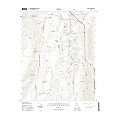
2014 Map of Tunnel Hill
USGS Topo · Published 2014About this map
Tunnel Hill serves as a focal point in this portion of North Georgia, where the historic Chetogeta Mountain Tunnel pierces the local ridge line. The landscape is defined by a series of parallel elevations including Taylor Ridge, Dick Ridge, and Tunnel Hill Ridge, which hem in the valleys of E Chickamauga Cr and Dry Cr. This 2014 survey documents the continued intersection of long-standing family landmarks and modern development, showing significant acreage dedicated to the Chattahoochee National Forest alongside institutions like Dalton State Coll.
Find a feature on this map
117 named features on this map. Tap any name to fly to it.
Don’t see what you’re looking for? This feature index may not catch every label — zoom into the map to look around manually.
Map Details
Editions of this 2014 Tunnel Hill Map
This is the sole edition of this map. No revisions or reprints were ever made.
Other maps of this area

1886 · Dalton
USGS Topo · 1:125,000

1886 · Ringgold
USGS Topo · 1:125,000

1892 · Ringgold
USGS Topo · 1:125,000

1892 · Dalton
USGS Topo · 1:125,000

1897 · Dalton
USGS Topo · 1:125,000

1935 · Catlett
USGS Topo · 1:24,000

1935 · East Ridge
USGS Topo · 1:24,000
1935 · Tiger Creek
USGS Topo · 1:24,000

1935 · Villanow
USGS Topo · 1:24,000

1935 · Ringgold
USGS Topo · 1:24,000