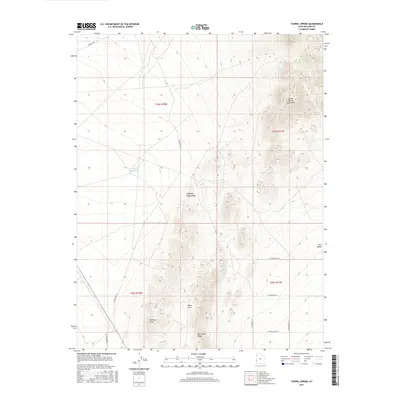
2017 Map of Tunnel Spring
USGS Topo · Published 2017About this map
Tunnel Spring serves as a vital water source in this arid corner of Millard County, situated on the eastern slopes of the Tunnel Spring Mountains. The landscape is defined by the drainage patterns of the Antelope Valley Wash and the presence of E Antelope Reservoir, illustrating the critical role of water management in the high desert. To the south, the terrain transitions into the Halfway Hills and the sheltered basin of Warm Cove, bound by the prominent Warm Cove Ridge. This region reflects a traditional Western ranching and resource geography, where remote access is maintained via a grid of secondary roads like Cowboy Rd and various numbered West and South streets. The survey provides a clear view of the topographic isolation and the essential features that have supported land use in the Great Basin region during the early twenty-first century.
Find a feature on this map
21 named features on this map. Tap any name to fly to it.
Don’t see what you’re looking for? This feature index may not catch every label — zoom into the map to look around manually.
Map Details
Editions of this 2017 Tunnel Spring Map
This is the sole edition of this map. No revisions or reprints were ever made.
Other maps of this area

1953 · Richfield
USGS Topo · 1:250,000

1958 · Richfield
USGS Topo · 1:250,000

1960 · Burbank Hills
USGS Topo · 1:62,500

1960 · Wah Wah Summit
USGS Topo · 1:62,500

1960 · Crystal Peak
USGS Topo · 1:62,500

1971 · Mountain Home Pass
USGS Topo · 1:24,000

1971 · Halfway Summit
USGS Topo · 1:24,000

1971 · Tunnel Spring
USGS Topo · 1:24,000

1971 · Mormon Gap
USGS Topo · 1:24,000

1980 · Wah Wah Mts. North
USGS Topo · 1:100,000