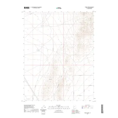
2023 Map of Tunnel Spring
USGS Topo · Published 2023About this map
Antelope Valley defines the western expanse of this high desert terrain, where the arid landscape is punctuated by vital water sources like Tunnel Spring and the East Antelope Reservoir. The eastern half of the map is dominated by the steep rises of the Tunnel Spring Mountains, while the Halfway Hills and Warm Cove Ridge create a complex topography to the south. This area of Millard County is sparsely developed, characterized by a network of sectional roads and trails including Cowboy Rd and S 28400 West St. The relationship between the flat valley floor and the surrounding ridges like Warm Cove illustrates the typical Great Basin geography, where access to water at sites like Tunnel Spring was essential for ranching and transit through these remote corridors.
Find a feature on this map
16 named features on this map. Tap any name to fly to it.
Don’t see what you’re looking for? This feature index may not catch every label — zoom into the map to look around manually.
Map Details
Editions of this 2023 Tunnel Spring Map
This is the sole edition of this map. No revisions or reprints were ever made.
Other maps of this area

1953 · Richfield
USGS Topo · 1:250,000

1958 · Richfield
USGS Topo · 1:250,000

1960 · Burbank Hills
USGS Topo · 1:62,500

1960 · Wah Wah Summit
USGS Topo · 1:62,500

1960 · Crystal Peak
USGS Topo · 1:62,500

1971 · Mountain Home Pass
USGS Topo · 1:24,000

1971 · Halfway Summit
USGS Topo · 1:24,000

1971 · Tunnel Spring
USGS Topo · 1:24,000

1971 · Mormon Gap
USGS Topo · 1:24,000

1980 · Wah Wah Mts. North
USGS Topo · 1:100,000