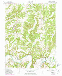
1958 Map of Tunnelton
USGS Topo · Published 1981About this map
The East Fork White River carves a sharp, winding course through this portion of Lawrence County, creating the distinctive Devils Backbone ridge just south of Tunnelton. The local economy and geography of the mid-20th century are defined by the Baltimore and Ohio railroad corridor, which tracks the river valley to serve the small settlements of Fort Ritner and the map's namesake town.
Find a feature on this map
41 named features on this map. Tap any name to fly to it.
Don’t see what you’re looking for? This feature index may not catch every label — zoom into the map to look around manually.
Map Details
Editions of this 1958 Tunnelton Map
2 editions found
Other maps of this area

1934 · Bedford
USGS Topo · 1:48,000

1937 · Bedford
USGS Topo · 1:62,500

1950 · Mitchell
USGS Topo · 1:24,000

1951 · Smedley
USGS Topo · 1:24,000

1956 · Vincennes
USGS Topo · 1:250,000

1957 · Vincennes
USGS Topo · 1:250,000

1957 · Campbellsburg
USGS Topo · 1:24,000

1958 · Vincennes
USGS Topo · 1:250,000
1958 · Bartlettsville
USGS Topo · 1:24,000
1958 · Norman
USGS Topo · 1:24,000