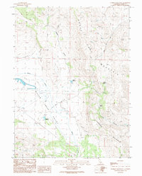
1989 Map of Tunnison Mountain
USGS Topo · Published 1989About this map
Horse Lake Mountain and Tunnison Mountain dominate this corner of Lassen County, where the high desert terrain meets the water management systems of the late twentieth century. In the low-lying Willow Creek Valley, the landscape is defined by engineered hydrology, notably seen in the Road on Levee and the presence of several catchment basins. The map identifies Gerrish as a focal point for local settlement or operation in an area otherwise characterized by springs and canyons. Water resources are carefully documented through features like Hagata Reservoir, Streshley Reservoir, and Antmas Spring. Small-scale industrial activity is evidenced by a Borrow Pit located near Morton Reservoir, while the inclusion of multiple Rock wall notations suggests historic property boundaries or livestock enclosures common to the region's ranching heritage.
Find a feature on this map
14 named features on this map. Tap any name to fly to it.
Don’t see what you’re looking for? This feature index may not catch every label — zoom into the map to look around manually.
Map Details
Editions of this 1989 Tunnison Mountain Map
This is the sole edition of this map. No revisions or reprints were ever made.
Other maps of this area

1886 · Honey Lake
USGS Topo · 1:250,000

1891 · Honey Lake
USGS Topo · 1:250,000

1893 · Honey Lake
USGS Topo · 1:250,000

1954 · Susanville
USGS Topo · 1:62,500

1954 · Litchfield
USGS Topo · 1:62,500

1954 · Karlo
USGS Topo · 1:62,500

1954 · Fredonyer Peak
USGS Topo · 1:62,500

1955 · Westwood
USGS Topo · 1:250,000

1958 · Westwood
USGS Topo · 1:250,000

1959 · Westwood
USGS Topo · 1:250,000