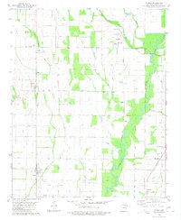
1980 Map of Tupelo
USGS Topo · Published 1980About this map
Tupelo and Weldon anchor this agricultural landscape in Jackson County, where the intricate hydrology of the Cache River and its various bypasses define the local economy. The map reveals a complex network of water management, including the Cypress Creek Ditch, Locust Creek Ditch, and numerous flumes and sloughs used to regulate the low-lying terrain. Small rural communities like Shoffner and Blackville are documented alongside vital neighborhood landmarks such as Mt Zion Ch and Maple Chapel. Aviation and infrastructure are represented by several small airstrips, including Livesay Landing Strip and Black Landing Field, while the southern portion of the quadrangle shows the distinctive terrain of Gourd Neck. This survey provides a precise look at the land's transition from river bottom to cultivated field just before the turn of the decade.
Find a feature on this map
30 named features on this map. Tap any name to fly to it.
Don’t see what you’re looking for? This feature index may not catch every label — zoom into the map to look around manually.
Map Details
Editions of this 1980 Tupelo Map
This is the sole edition of this map. No revisions or reprints were ever made.
Other maps of this area

1935 · Newport
USGS Topo · 1:62,500

1935 · Augusta
USGS Topo · 1:62,500

1935 · Tuckerman
USGS Topo · 1:62,500

1940 · Tilton
USGS Topo · 1:62,500

1953 · Memphis
USGS Topo · 1:250,000

1956 · Memphis
USGS Topo · 1:250,000

1956 · Tilton
USGS Topo · 1:62,500

1957 · Augusta
USGS Topo · 1:62,500

1962 · Newport
USGS Topo · 1:24,000
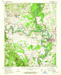
1962 · Newport
USGS Topo · 1:62,500