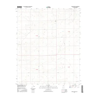
2017 Map of Turkey Ridge NE
USGS Topo · Published 2017About this map
White Lake Cem stands as a primary landmark in this expansive New Mexico landscape, situated north of the ephemeral White Lake. The area is defined by a sparse network of county roads and section lines, reflecting a traditional ranching or agricultural pattern typical of Socorro County. To the south, Horse Bit Ln and Co Rd 208 traverse the high desert terrain, providing access to remote sections within the Public Land Survey System boundaries of T1S R8E and T2S R9E. This 2017 U.S. Geological Survey representation highlights the intersection of modern cartographic data with historical land divisions, where gravel routes like Co Rd 191 and Co Rd 193 remain the vital connectors across the ridge-and-valley topography.
Find a feature on this map
11 named features on this map. Tap any name to fly to it.
Don’t see what you’re looking for? This feature index may not catch every label — zoom into the map to look around manually.
Map Details
Editions of this 2017 Turkey Ridge NE Map
This is the sole edition of this map. No revisions or reprints were ever made.
Other maps of this area

1954 · Fort Sumner
USGS Topo · 1:250,000

1954 · Socorro
USGS Topo · 1:250,000

1958 · Socorro
USGS Topo · 1:250,000

1958 · Fort Sumner
USGS Topo · 1:250,000

1962 · Socorro
USGS Topo · 1:250,000

1972 · Turkey Ridge
USGS Topo · 1:24,000

1972 · Turkey Ridge SW
USGS Topo · 1:24,000

1972 · Gran Quivira
USGS Topo · 1:24,000

1972 · Bigbee Draw
USGS Topo · 1:24,000
1972 · Cat Mesa
USGS Topo · 1:24,000