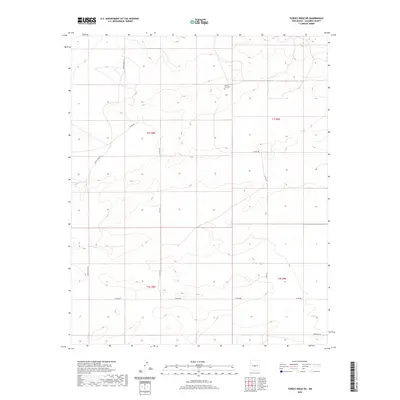
2020 Map of Turkey Ridge NE
USGS Topo · Published 2020About this map
White Lake Cem stands as a solitary landmark in this high-desert landscape of Socorro County, situated near the boundary of T1S R8E and T1S R9E. The terrain is defined by a sparse but organized network of rural routes and county roads that navigate the arid topography. Major thoroughfares such as WSMR P Route 41 and Co RD 206 cross the quadrangle, indicating the managed nature of this open range. The transition from Co RD 191 to Co RD 208 in the southern sections suggests a landscape primarily utilized for transit or ranching operations rather than dense settlement. This 2020 survey provides a clear view of the modern rural infrastructure, including localized access points like Horse Bit Ln, which contrasts with the larger surveyor-defined township and range grids.
Find a feature on this map
11 named features on this map. Tap any name to fly to it.
Don’t see what you’re looking for? This feature index may not catch every label — zoom into the map to look around manually.
Map Details
Editions of this 2020 Turkey Ridge NE Map
This is the sole edition of this map. No revisions or reprints were ever made.
Other maps of this area

1954 · Fort Sumner
USGS Topo · 1:250,000

1954 · Socorro
USGS Topo · 1:250,000

1958 · Socorro
USGS Topo · 1:250,000

1958 · Fort Sumner
USGS Topo · 1:250,000

1962 · Socorro
USGS Topo · 1:250,000

1972 · Turkey Ridge
USGS Topo · 1:24,000

1972 · Turkey Ridge SW
USGS Topo · 1:24,000

1972 · Gran Quivira
USGS Topo · 1:24,000

1972 · Bigbee Draw
USGS Topo · 1:24,000
1972 · Cat Mesa
USGS Topo · 1:24,000