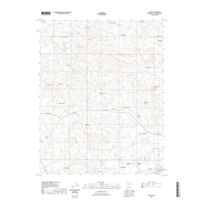
2020 Map of Turley
USGS Topo · Published 2020About this map
The San Juan River flows through the southern portion of this landscape, anchoring the small settlement of Turley. This high-desert terrain is defined by a dense network of canyons and natural formations, most notably several named arches including Little Delicate Arch, Pemada Canyon Arch, and Crow Canyon Arch. The topographic detail reveals a land shaped by water, with dozens of named springs such as Cash Spring, Bootlegger Spring, and Indian Spring tucked into the drainages of Hart Canyon and Alamo Canyon. Rising above the arroyos, landmarks like Hart Mtn and Slane Knob provide vertical relief in an area crisscrossed by access roads like Navajo Dam Rd. The presence of Burro Spring Bridge and numerous ranch-related tracks underscores the intersection of natural geography and the cattle-grazing or oil-and-gas infrastructure common to San Juan County.
Find a feature on this map
65 named features on this map. Tap any name to fly to it.
Don’t see what you’re looking for? This feature index may not catch every label — zoom into the map to look around manually.
Map Details
Editions of this 2020 Turley Map
This is the sole edition of this map. No revisions or reprints were ever made.
Other maps of this area

1889 · Largo
USGS Topo · 1:250,000

1895 · Largo
USGS Topo · 1:250,000

1954 · Aztec
USGS Topo · 1:250,000

1958 · Aztec
USGS Topo · 1:250,000

1959 · Gould Pass
USGS Topo · 1:62,500

1959 · Aztec
USGS Topo · 1:62,500

1959 · Navajo Dam
USGS Topo · 1:62,500

1960 · Bloomfield
USGS Topo · 1:62,500

1962 · Aztec
USGS Topo · 1:250,000

1965 · Aztec
USGS Topo · 1:250,000