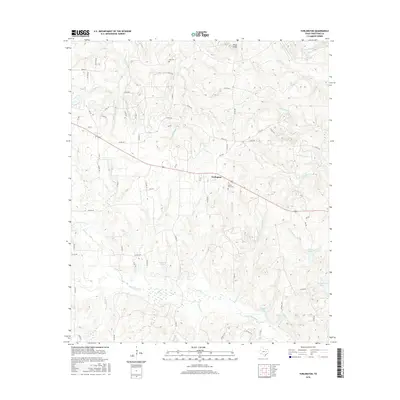
2016 Map of Turlington
USGS Topo · Published 2016About this map
Turlington and its surrounding countryside in Freestone County are defined by a complex network of creeks and small, named lakes. The landscape is carved by numerous watercourses, including Upper Keechi Cr, Big Brown Cr, and Negro Cr, which feed into various reservoirs such as Richards Lake, Morse Lake, and Wilson Lake. The terrain rises toward Pilot Knob in the north, offering a clear view of the drainage patterns that shaped local land use. Family and local history are anchored by sites like Mount Zion Cem and Day Cem, while a dense grid of county roads and oil-related infrastructure, such as Oil Rig Rd and Oil Field Rd, indicates the area's continued reliance on natural resource extraction and rural agriculture.
Find a feature on this map
80 named features on this map. Tap any name to fly to it.
Don’t see what you’re looking for? This feature index may not catch every label — zoom into the map to look around manually.
Map Details
Editions of this 2016 Turlington Map
This is the sole edition of this map. No revisions or reprints were ever made.
Other maps of this area

1919 · Fairfield
USGS Topo · 1:62,500

1949 · Tennessee Colony
USGS Topo · 1:62,500

1950 · Tennessee Colony
USGS Topo · 1:62,500

1953 · Palestine
USGS Topo · 1:250,000

1954 · Waco
USGS Topo · 1:250,000

1955 · Waco
USGS Topo · 1:250,000

1957 · Palestine
USGS Topo · 1:250,000

1961 · Young
USGS Topo · 1:24,000
1963 · Stewards Mill
USGS Topo · 1:24,000

1964 · Keechi
USGS Topo · 1:24,000