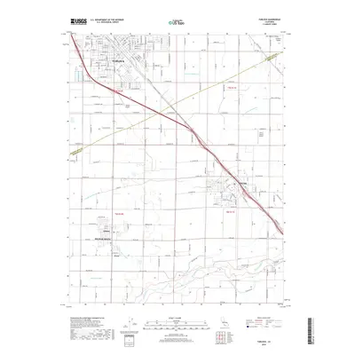
2018 Map of Turlock
USGS Topo · Published 2018About this map
Turlock and its southern agricultural surroundings define this portion of the San Joaquin Valley in the late 2010s. The landscape is characterized by a dense grid of rural roads and an intricate irrigation network including the Riverside Ditch, Garibaldi Lateral, and Lateral Number Six, all supporting the productive lands of the Central Valley. To the southeast, the Merced River meanders toward its confluence, marking the southern boundary of this survey near the unincorporated communities of Delhi, Hilmar, and Irwin. Transportation and aviation history is preserved here through landmarks such as the Santa Fe Ave corridor, Turlock Airpark, and the Florini Ranch Airport. Within the city limits, Turlock Memorial Park stands as a significant local landmark amidst the residential and commercial expansion of the era.
Find a feature on this map
66 named features on this map. Tap any name to fly to it.
Don’t see what you’re looking for? This feature index may not catch every label — zoom into the map to look around manually.
Map Details
Editions of this 2018 Turlock Map
This is the sole edition of this map. No revisions or reprints were ever made.
Other maps of this area

1916 · Mitchell School
USGS Topo · 1:31,680

1916 · Cressey
USGS Topo · 1:31,680

1916 · Montpellier
USGS Topo · 1:31,680

1916 · Denair
USGS Topo · 1:31,680

1916 · Ceres
USGS Topo · 1:31,680

1917 · Turlock
USGS Topo · 1:31,680

1918 · Arena
USGS Topo · 1:31,680

1918 · Stevinson
USGS Topo · 1:31,680

1918 · Gustine
USGS Topo · 1:31,680

1939 · Modesto East
USGS Topo · 1:62,500