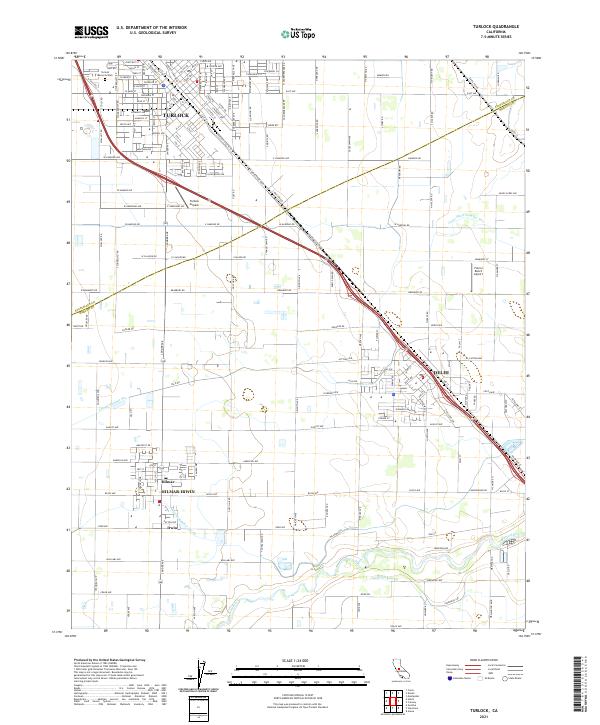
2021 Map of Turlock
USGS Topo · Published 2021About this map
The Turlock street grid and surrounding agricultural landscape of the northern San Joaquin Valley are defined by a complex network of irrigation channels and established transportation corridors. The Union Pacific line runs diagonally through the territory, passing through Delhi and paralleling the N Golden State Blvd. This 2021 survey illustrates the continued importance of water management in the region, featuring named infrastructure like the Garibaldi Lateral, Lateral Number Six, and Cross Ditch Number Two. To the south, the Merced River meanders along the boundary between Stanislaus and Merced counties, anchoring the communities of Hilmar, Irwin, and the combined Hilmar-Irwin area. Aviation and local landmarks are well-documented, including the Turlock Airpark south of the city center and the Fiorini Ranch Airport near the eastern edge. Local genealogists will find the exact layout of Turlock Memorial Park and dozens of family-named rural roads throughout the quadrangle.
Find a feature on this map
143 named features on this map. Tap any name to fly to it.
Don’t see what you’re looking for? This feature index may not catch every label — zoom into the map to look around manually.
Map Details
Editions of this 2021 Turlock Map
This is the sole edition of this map. No revisions or reprints were ever made.
Other maps of this area

1916 · Mitchell School
USGS Topo · 1:31,680

1916 · Cressey
USGS Topo · 1:31,680

1916 · Montpellier
USGS Topo · 1:31,680

1916 · Denair
USGS Topo · 1:31,680

1916 · Ceres
USGS Topo · 1:31,680

1917 · Turlock
USGS Topo · 1:31,680

1918 · Arena
USGS Topo · 1:31,680

1918 · Stevinson
USGS Topo · 1:31,680

1918 · Gustine
USGS Topo · 1:31,680

1939 · Modesto East
USGS Topo · 1:62,500