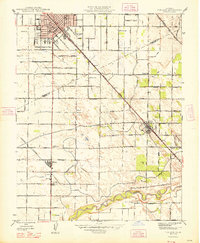
1948 Map of Turlock
USGS Topo · Published 1948About this map
The agricultural landscape of the San Joaquin Valley is meticulously documented in this 1948 edition, showing the expansion of Turlock and nearby rural communities following the post-war culture revision. The map highlights a complex irrigation network vital to the region's productivity, featuring prominent waterways like the Turlock Canal, High Line Canal, and several numbered laterals such as Lateral No 6. These engineered flows parallel the course of the Merced River in the south, which defines the natural drainage of the territory.
Find a feature on this map
83 named features on this map. Tap any name to fly to it.
Don’t see what you’re looking for? This feature index may not catch every label — zoom into the map to look around manually.
Map Details
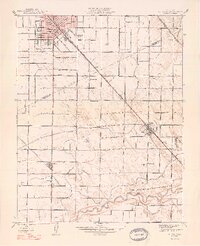
Editions of this 1948 Turlock Map
2 editions found
Other maps of this area

1916 · Mitchell School
USGS Topo · 1:31,680

1916 · Cressey
USGS Topo · 1:31,680

1916 · Montpellier
USGS Topo · 1:31,680

1916 · Denair
USGS Topo · 1:31,680

1916 · Ceres
USGS Topo · 1:31,680

1917 · Turlock
USGS Topo · 1:31,680

1918 · Arena
USGS Topo · 1:31,680

1918 · Stevinson
USGS Topo · 1:31,680

1918 · Gustine
USGS Topo · 1:31,680

1939 · Modesto East
USGS Topo · 1:62,500