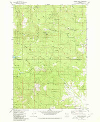
1979 Map of Turner Creek
USGS Topo · Published 1980About this map
Tillamook State Forest covers the northern reaches of this landscape, where the upper Tualatin River and its numerous tributaries cut through a series of prominent landforms like Baseline Ridge and Hagerty Ridge. The presence of Hillsboro Reservoir and Barney Reservoir highlights the area's role in water management for the region. Industrial activity is evidenced by several scattered quarries and borrow pits, alongside a dense network of timber-access routes including the Stimson Mainline Road and Flora Mainline.
Find a feature on this map
41 named features on this map. Tap any name to fly to it.
Don’t see what you’re looking for? This feature index may not catch every label — zoom into the map to look around manually.
Map Details
Editions of this 1979 Turner Creek Map
2 editions found
Other maps of this area

1941 · Timber
USGS Topo · 1:62,500

1941 · Gales Creek
USGS Topo · 1:62,500

1941 · Yamhill
USGS Topo · 1:62,500

1942 · Yamhill
USGS Topo · 1:62,500

1942 · Fairdale
USGS Topo · 1:62,500

1948 · Vancouver
USGS Topo · 1:250,000

1950 · Vancouver
USGS Topo · 1:250,000

1950 · Vancouver
USGS Topo · 1:250,000

1955 · Timber
USGS Topo · 1:62,500

1955 · Fairdale
USGS Topo · 1:62,500