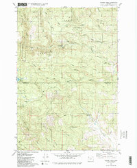
1979 Map of Turner Creek
USGS Topo · Published 1980About this map
The Tillamook State Forest dominates the topography of this region, where the Tualatin River begins its course amidst a network of high ridges and deep drainages. In the late 1970s, this landscape was defined by industrial timber operations and water management, evidenced by the Barney Reservoir and Hillsboro Reservoir nestled in the upland valleys. The map documents the boundary between Washington and Yamhill counties, tracing the crests of Blind Cabin Ridge and Hagerty Ridge.
Find a feature on this map
39 named features on this map. Tap any name to fly to it.
Don’t see what you’re looking for? This feature index may not catch every label — zoom into the map to look around manually.
Map Details
Editions of this 1979 Turner Creek Map
2 editions found
Other maps of this area

1941 · Timber
USGS Topo · 1:62,500

1941 · Gales Creek
USGS Topo · 1:62,500

1941 · Yamhill
USGS Topo · 1:62,500

1942 · Yamhill
USGS Topo · 1:62,500

1942 · Fairdale
USGS Topo · 1:62,500

1948 · Vancouver
USGS Topo · 1:250,000

1950 · Vancouver
USGS Topo · 1:250,000

1950 · Vancouver
USGS Topo · 1:250,000

1955 · Timber
USGS Topo · 1:62,500

1955 · Fairdale
USGS Topo · 1:62,500