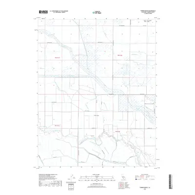
2018 Map of Turner Ranch
USGS Topo · Published 2018About this map
Turner Island and the surrounding basin of the San Joaquin Valley define this landscape, where complex water management systems dominate the terrain. A dense network of man-made and natural waterways, including the San Joaquin River, Salt Slough, and Mariposa Slough, illustrates the intricate irrigation and drainage efforts required to support the local agricultural economy. Features like the Loop Ditch Number One, Siphon Ditch, and Delta Canal crisscross the region, serving the eponymous Turner Ranch and neighboring parcels. To the east, the Merced National Wildlife Refuge provides a significant preserved wetland environment amidst the grid of rural roads such as Sandy Mush Rd and Nickel Rd. This survey captures the specialized infrastructure of the Central Valley just before the 2020s, showing how local drainage like the Pick Anderson Drain and various lateral canals manage the river's flow through the valley floor.
Find a feature on this map
47 named features on this map. Tap any name to fly to it.
Don’t see what you’re looking for? This feature index may not catch every label — zoom into the map to look around manually.
Map Details
Editions of this 2018 Turner Ranch Map
This is the sole edition of this map. No revisions or reprints were ever made.
Other maps of this area

1916 · Santa Rita Bridge
USGS Topo · 1:24,000

1916 · Delta Ranch
USGS Topo · 1:24,000

1918 · Arena
USGS Topo · 1:31,680

1918 · Atwater
USGS Topo · 1:31,680

1918 · Stevinson
USGS Topo · 1:31,680

1918 · Sandy Mush
USGS Topo · 1:31,680

1918 · Turner Ranch
USGS Topo · 1:31,680

1919 · San Luis Ranch
USGS Topo · 1:31,680

1920 · Santa Rita Bridge
USGS Topo · 1:31,680

1921 · Los Banos
USGS Topo · 1:31,680