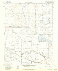
1961 Map of Turner Ranch
USGS Topo · Published 1962About this map
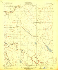
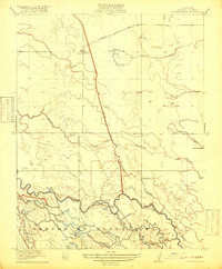
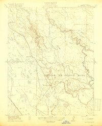
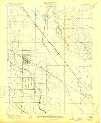
The Merced National Wildlife Refuge dominates this Central Valley landscape, illustrating the critical role of managed wetlands and sloughs in the Merced County region. Water management is the primary theme of this 1961 survey, evidenced by the extensive network of the East Side Bypass and Mariposa Bypass, which channel runoff through the flatlands. Large family and commercial holdings like Crane Ranch, McNamara Ranch, and the namesake Turner Ranch define the land-use patterns of the era. The presence of the Flynn Duck Club and numerous labeled Duck Ponds highlights the historical significance of the Pacific Flyway and the region's hunting culture. Along the winding San Joaquin River and Turner Island, the map captures a complex system of siphons, ditches, and sloughs such as Deep Slough and South Slough that supported the agricultural and conservation efforts of the mid-20th century.
Find a feature on this map
32 named features on this map. Tap any name to fly to it.
Don’t see what you’re looking for? This feature index may not catch every label — zoom into the map to look around manually.
Map Details
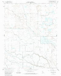
Editions of this 1961 Turner Ranch Map
3 editions found

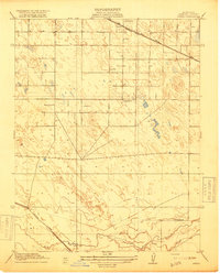
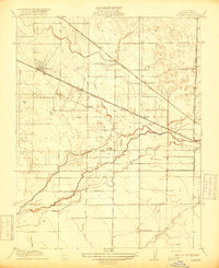
Other maps of this area

1916 · Santa Rita Bridge
USGS Topo · 1:24,000

1916 · Delta Ranch
USGS Topo · 1:24,000
1918 · Arena
USGS Topo · 1:31,680
1918 · Atwater
USGS Topo · 1:31,680
1918 · Stevinson
USGS Topo · 1:31,680

1918 · Sandy Mush
USGS Topo · 1:31,680
1918 · Turner Ranch
USGS Topo · 1:31,680
1919 · San Luis Ranch
USGS Topo · 1:31,680

1920 · Santa Rita Bridge
USGS Topo · 1:31,680
1921 · Los Banos
USGS Topo · 1:31,680