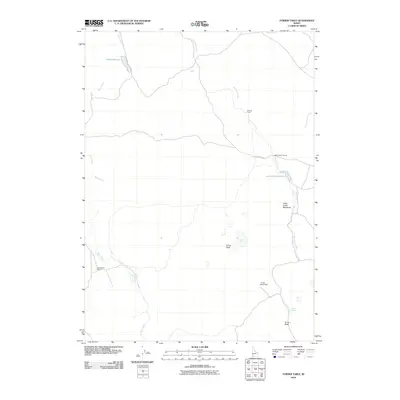
2010 Map of Turner Table
USGS Topo · Published 2010About this map
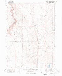
Morrow Ranch and Monasterio Ranch anchor this landscape in Owyhee County, illustrating the enduring cattle-ranching heritage of southwestern Idaho. Water management is central to the area's utility, with Whites Reservoir and Jacks Creek Reservoir providing vital catchments in an otherwise arid high-desert environment. The drainage of Big Jacks Creek and Blue Creek dictates the movement of people and livestock, while natural features like Turner Table and Turner Butte serve as prominent regional landmarks. Historical transit routes are evidenced by Jacks Creek Crossing and Jacks Creek Rd, which provide access to the riparian environments of Jacks Creek Meadows and the secluded Turner Spring. This map records a sparsely populated grazing territory where survival is tied to the careful tracking of water sources and the terrain's distinct volcanic geology.
Find a feature on this map
14 named features on this map. Tap any name to fly to it.
Don’t see what you’re looking for? This feature index may not catch every label — zoom into the map to look around manually.
Map Details
Editions of this 2010 Turner Table Map
This is the sole edition of this map. No revisions or reprints were ever made.
Other maps of this area

1955 · Jordan Valley
USGS Topo · 1:250,000

1957 · Jordan Valley
USGS Topo · 1:250,000

1958 · Jordan Valley
USGS Topo · 1:250,000
1972 · Hill Pasture
USGS Topo · 1:24,000

1972 · Wickahoney Point
USGS Topo · 1:24,000

1972 · Little Blue Table
USGS Topo · 1:24,000
1972 · Crab Spring Butte
USGS Topo · 1:24,000

1972 · Turner Table
USGS Topo · 1:24,000
1972 · Nichol Flat
USGS Topo · 1:24,000
1972 · Shoofly Springs
USGS Topo · 1:24,000