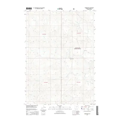
2015 Map of Turnercrest
USGS Topo · Published 2015About this map
Thunder Basin National Grassland dominates the eastern half of this terrain, where the high plains of Campbell County are etched by a complex drainage system. The topography is defined by the winding course of Bates Cr, which receives flow from N Bates Cr and Little Bates Cr. Near the center of the sheet, the small settlement of Turnercrest sits at a junction of local routes, serving as a rare focal point in an otherwise expansive landscape of open range and subtle relief. To the south, the perennial water source of Mexican Springs provides a critical landmark in the arid environment. The map also captures the level topography of Reno Flats to the east, illustrating the varied land use patterns between federally managed grasslands and private holdings defined by the Public Land Survey System grids of T41N and T42N.
Find a feature on this map
11 named features on this map. Tap any name to fly to it.
Don’t see what you’re looking for? This feature index may not catch every label — zoom into the map to look around manually.
Map Details
Editions of this 2015 Turnercrest Map
This is the sole edition of this map. No revisions or reprints were ever made.
Other maps of this area

1953 · South Butte
USGS Topo · 1:24,000

1954 · Pine Tree
USGS Topo · 1:24,000

1955 · Newcastle
USGS Topo · 1:250,000

1958 · Newcastle
USGS Topo · 1:250,000

1959 · Coal Draw
USGS Topo · 1:62,500

1960 · Ross
USGS Topo · 1:62,500

1960 · Turnercrest
USGS Topo · 1:62,500

1974 · Reno Junction
USGS Topo · 1:100,000

1979 · Bill
USGS Topo · 1:100,000

1984 · Turnercrest
USGS Topo · 1:24,000