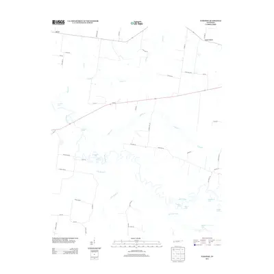
2013 Map of Turnpike
USGS Topo · Published 2013About this map
The Hatchie River meanders through this West Tennessee landscape, defining a complex system of oxbows and bottomlands near the small settlements of Turnpike and Orysa. The river's historical influence on the terrain is evident in features like Horseshoe Lake, Round Hole Lake, and Double Basin, which illustrate the shifting course of the waterway over time. To the south, the Big Muddy Canal represents a significant modification of the natural drainage system, running parallel to Little Muddy Cr. Local roads such as Bond Ferry Rd and Guinn Bottom Rd hint at the rural agricultural life and river crossings that have long supported these communities. The presence of Saint Peters in the northeast and family-named routes like Jess Rice Rd and Bevis Rd provide specific points of interest for genealogists tracing regional land ownership and family settlements.
Find a feature on this map
49 named features on this map. Tap any name to fly to it.
Don’t see what you’re looking for? This feature index may not catch every label — zoom into the map to look around manually.
Map Details
Editions of this 2013 Turnpike Map
This is the sole edition of this map. No revisions or reprints were ever made.
Other maps of this area

1950 · Brownsville
USGS Topo · 1:24,000

1951 · Brownsville
USGS Topo · 1:24,000

1952 · Stanton
USGS Topo · 1:24,000

1952 · Dancyville
USGS Topo · 1:24,000

1952 · Stanton
USGS Topo · 1:62,500

1954 · Mason
USGS Topo · 1:62,500

1956 · Blytheville
USGS Topo · 1:250,000

1959 · Blytheville
USGS Topo · 1:250,000

1961 · Rialto
USGS Topo · 1:62,500

1962 · Rialto
USGS Topo · 1:62,500