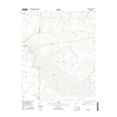
2016 Map of Turnpike
USGS Topo · Published 2016About this map
The Hatchie River defines the complex hydrography of this West Tennessee landscape, creating a broad expanse known as Hatchie Bottom. This wetland environment is characterized by numerous oxbow lakes and basins, including Horseshoe Lake, Round Hole Lake, and Double Basin. The settlement pattern is largely confined to the higher ground surrounding the river valley, with the small community of Turnpike and the crossroads at Orysa serving as primary landmarks. Genealogists will find several family-named and local burial sites scattered across the quadrangle, such as Macedonia Mercer Cem, Walker Cem, and Outlaw Cem. The road network, featuring names like Bear Waller Rd and Byars Store Rd, reflects a deeply rooted rural infrastructure that navigates the tributary system of Cypress Cr and Little Muddy Cr.
Find a feature on this map
55 named features on this map. Tap any name to fly to it.
Don’t see what you’re looking for? This feature index may not catch every label — zoom into the map to look around manually.
Map Details
Editions of this 2016 Turnpike Map
This is the sole edition of this map. No revisions or reprints were ever made.
Other maps of this area

1950 · Brownsville
USGS Topo · 1:24,000

1951 · Brownsville
USGS Topo · 1:24,000

1952 · Stanton
USGS Topo · 1:24,000

1952 · Dancyville
USGS Topo · 1:24,000

1952 · Stanton
USGS Topo · 1:62,500

1954 · Mason
USGS Topo · 1:62,500

1956 · Blytheville
USGS Topo · 1:250,000

1959 · Blytheville
USGS Topo · 1:250,000

1961 · Rialto
USGS Topo · 1:62,500

1962 · Rialto
USGS Topo · 1:62,500