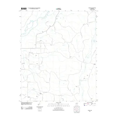
2012 Map of Turon
USGS Topo · Published 2012About this map
Turon and Parham anchor this rural landscape in Monroe County, where the topography is defined by the winding paths of Bull Mountain Cr and Splunge Cr. The settlement pattern is deeply connected to family-named landmarks and local infrastructure, such as Rye Field Airport and the Splunge Lookout Tower. A dense concentration of country burial grounds, including Springfield Cem, New Hope Cem, and Dyer Cem, provides a detailed record of the families who settled this corner of Mississippi. Roads like Old Aberdeen-Russeville Rd and Jug Shop Rd hint at historic transit routes between early community centers. The map shows a region shaped by its numerous smaller tributaries, like Hadaway Cr and Section Cr, which continue to dictate the placement of rural residences and small hamlets like Bristow and Riggins.
Find a feature on this map
82 named features on this map. Tap any name to fly to it.
Don’t see what you’re looking for? This feature index may not catch every label — zoom into the map to look around manually.
Map Details
Editions of this 2012 Turon Map
This is the sole edition of this map. No revisions or reprints were ever made.
Other maps of this area

1953 · West Point
USGS Topo · 1:250,000

1956 · Tupelo
USGS Topo · 1:250,000

1958 · Tupelo
USGS Topo · 1:250,000

1958 · West Point
USGS Topo · 1:250,000

1963 · West Point
USGS Topo · 1:250,000

1966 · Smithville
USGS Topo · 1:24,000

1966 · Beans Ferry
USGS Topo · 1:24,000

1966 · Amory
USGS Topo · 1:24,000

1966 · Turon
USGS Topo · 1:24,000

1966 · Tremont
USGS Topo · 1:24,000