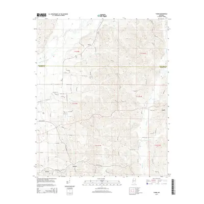
2015 Map of Turon
USGS Topo · Published 2015About this map
The small settlements of Turon and Parham anchor this landscape along the Itawamba and Monroe County border. The map documents a rural network of family-named roads and landmarks, including Sams Sawmill Rd and Filtrol Rd, suggesting the historical local importance of timber and mineral processing. Waterways like Bull Mountain Creek and Splunge Cr snake through the terrain, which is dotted with numerous small family burial grounds such as Dyer Cem, Wylie Cem, and Cowley Cem. This concentration of cemeteries, including New Hope Cem near Bristow, provides a significant resource for genealogists tracing families in this part of Mississippi. The road names, such as Jug Shop Rd and Parham Store Rd, further reflect a history of local commerce and craftsmanship within these small communities.
Find a feature on this map
81 named features on this map. Tap any name to fly to it.
Don’t see what you’re looking for? This feature index may not catch every label — zoom into the map to look around manually.
Map Details
Editions of this 2015 Turon Map
This is the sole edition of this map. No revisions or reprints were ever made.
Other maps of this area

1953 · West Point
USGS Topo · 1:250,000

1956 · Tupelo
USGS Topo · 1:250,000

1958 · Tupelo
USGS Topo · 1:250,000

1958 · West Point
USGS Topo · 1:250,000

1963 · West Point
USGS Topo · 1:250,000

1966 · Smithville
USGS Topo · 1:24,000

1966 · Beans Ferry
USGS Topo · 1:24,000

1966 · Amory
USGS Topo · 1:24,000

1966 · Turon
USGS Topo · 1:24,000

1966 · Tremont
USGS Topo · 1:24,000