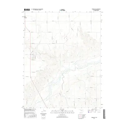
2016 Map of Turpin East
USGS Topo · Published 2016About this map
Turpin sits in the northwest corner of this Oklahoma Panhandle landscape, where the High Plains are deeply etched by the meandering path of the Beaver River. The riverbed, often wide and braided, dominates the southern half of the map, creating a complex network of wetlands and seasonal drainages. Tributaries like Sharp Cr and Jackson Cr carve distinct ravines into the surrounding tableland, illustrating the erosive power of water in this semi-arid region.
Find a feature on this map
38 named features on this map. Tap any name to fly to it.
Don’t see what you’re looking for? This feature index may not catch every label — zoom into the map to look around manually.
Map Details
Editions of this 2016 Turpin East Map
This is the sole edition of this map. No revisions or reprints were ever made.
Other maps of this area

1954 · Perryton
USGS Topo · 1:250,000

1958 · Perryton
USGS Topo · 1:250,000

1973 · Balko
USGS Topo · 1:24,000

1973 · Boyd
USGS Topo · 1:24,000

1973 · Floris
USGS Topo · 1:24,000

1973 · Little Ponderosa
USGS Topo · 1:24,000

1973 · Turpin East
USGS Topo · 1:24,000

1973 · Red Horse Creek
USGS Topo · 1:24,000
1973 · Beaver NW
USGS Topo · 1:24,000
1973 · Turpin NE
USGS Topo · 1:24,000