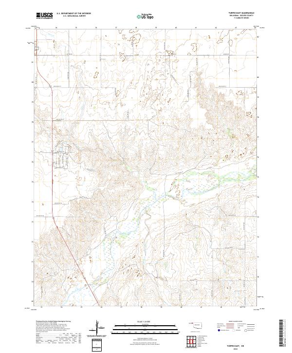
2022 Map of Turpin East
USGS Topo · Published 2022About this map
The Beaver River winds through the high plains of the Oklahoma Panhandle, defining the drainage patterns and topography of this Beaver County landscape. The river corridor is flanked by a network of intermittent tributaries, including Short Cr, Sharp Cr, and Jackson Creek, which have carved subtle valleys into the surrounding tableland. This 2022 survey illustrates a land organized by the Public Land Survey System, where modern infrastructure adheres strictly to section lines.
Find a feature on this map
44 named features on this map. Tap any name to fly to it.
Don’t see what you’re looking for? This feature index may not catch every label — zoom into the map to look around manually.
Map Details
Editions of this 2022 Turpin East Map
This is the sole edition of this map. No revisions or reprints were ever made.
Other maps of this area

1954 · Perryton
USGS Topo · 1:250,000

1958 · Perryton
USGS Topo · 1:250,000

1973 · Balko
USGS Topo · 1:24,000

1973 · Boyd
USGS Topo · 1:24,000

1973 · Floris
USGS Topo · 1:24,000

1973 · Little Ponderosa
USGS Topo · 1:24,000

1973 · Turpin East
USGS Topo · 1:24,000

1973 · Red Horse Creek
USGS Topo · 1:24,000
1973 · Beaver NW
USGS Topo · 1:24,000
1973 · Turpin NE
USGS Topo · 1:24,000