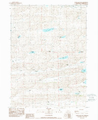
1989 Map of Turpin Lake West
USGS Topo · Published 1989About this map
The Nebraska Sandhills of Cherry County are defined by a complex network of ranching homesteads and hydrologic basins in this late 1980s record. Named ranching operations like the U-Cross Ranch and Blaine Runner Ranch dot the landscape, indicating the long-standing cattle-rearing economy of the region. The map highlights the localized importance of water management in an arid environment, noting features such as a Flowing Well and an Irr Well, alongside the educational anchor of the Gordon Creek Sch.
Find a feature on this map
32 named features on this map. Tap any name to fly to it.
Don’t see what you’re looking for? This feature index may not catch every label — zoom into the map to look around manually.
Map Details
Editions of this 1989 Turpin Lake West Map
This is the sole edition of this map. No revisions or reprints were ever made.
Other maps of this area

1948 · Spade Ranch
USGS Topo · 1:62,500

1949 · Turpin Lake
USGS Topo · 1:62,500

1950 · Spade Ranch
USGS Topo · 1:62,500

1951 · Gypsy Valley
USGS Topo · 1:62,500

1951 · Turpin Lake
USGS Topo · 1:62,500

1955 · Alliance
USGS Topo · 1:250,000

1957 · Alliance
USGS Topo · 1:250,000

1957 · Valentine
USGS Topo · 1:250,000

1958 · Alliance
USGS Topo · 1:250,000

1959 · Valentine
USGS Topo · 1:250,000