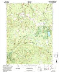
1992 Map of Turpin Reservoir
USGS Topo · Published 1996About this map
Medicine Bow National Forest encompasses this high-altitude landscape in the Sierra Madre range, where the 1990s terrain is defined by a network of creeks and isolated mountain parks. The central engineering feature is the Turpin Reservoir, fed by Turpin Creek and several unnamed tributaries. This area serves as a critical watershed, with North Brush Creek, Deep Creek, and Cassidy Creek draining the timbered slopes. Evidence of historic resource extraction is visible at the Golden Gate Prospect near North Fork Mullison Creek. Navigation through the dense forest relies on seasonal routes like Cedar Pass Road and Richardson Road, which cross through open meadows such as Fish Creek Park and Cecil Park. The map provides a precise record of the road network and water management features just before the turn of the 21st century.
Find a feature on this map
20 named features on this map. Tap any name to fly to it.
Don’t see what you’re looking for? This feature index may not catch every label — zoom into the map to look around manually.
Map Details
Editions of this 1992 Turpin Reservoir Map
This is the sole edition of this map. No revisions or reprints were ever made.
Other maps of this area

1893 · Fort Steele
USGS Topo · 1:125,000

1906 · Medicine Bow
USGS Topo · 1:125,000

1908 · Medicine Bow
USGS Topo · 1:125,000

1939 · Saratoga
USGS Topo · 1:125,000

1954 · Rawlins
USGS Topo · 1:250,000

1955 · Elk Mountain SW
USGS Topo · 1:24,000

1955 · Coad Mountain
USGS Topo · 1:24,000

1958 · Rawlins
USGS Topo · 1:250,000

1958 · White Rock Canyon
USGS Topo · 1:24,000

1961 · Ryan Park
USGS Topo · 1:24,000