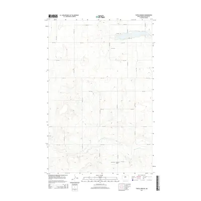
2014 Map of Turtle Creek SE
USGS Topo · Published 2014About this map
Painted Woods Cr winds through the southern reaches of this McLean County landscape, where the terrain is marked by a systematic grid of section lines and gravel roads. In the northern section, N Canal Rd and S Canal Rd run parallel to a narrow waterway, suggesting a highly managed agricultural environment in this part of North Dakota. For those researching local family histories, Zion Cem stands as a primary landmark in the northern highlands, while the Soderquist Airport to the south provides a unique waypoint for this rural stretch. The 2014 survey reveals a territory primarily shaped by large-scale farming and the infrastructure required to support the Missouri River basin’s water management systems.
Find a feature on this map
15 named features on this map. Tap any name to fly to it.
Don’t see what you’re looking for? This feature index may not catch every label — zoom into the map to look around manually.
Map Details
Editions of this 2014 Turtle Creek SE Map
This is the sole edition of this map. No revisions or reprints were ever made.
Other maps of this area

1949 · Turtle Creek
USGS Topo · 1:62,500

1950 · Wilton
USGS Topo · 1:62,500

1954 · McClusky
USGS Topo · 1:250,000

1958 · McClusky
USGS Topo · 1:250,000

1959 · Mercer
USGS Topo · 1:24,000

1959 · Mercer SW
USGS Topo · 1:24,000

1961 · Turtle Creek SW
USGS Topo · 1:24,000

1961 · Turtle Creek NE
USGS Topo · 1:24,000

1961 · Turtle Creek NW
USGS Topo · 1:24,000

1961 · Turtle Creek SE
USGS Topo · 1:24,000