
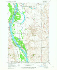
1961 Map of Turtle Creek SE
USGS Topo · Published 1963About this map
Fairview Ch and the neighboring Zion Cem stand as central landmarks in this rural McLean County landscape, surveyed in the late 1950s for the Missouri River Basin development program. The map reveals a highly organized township structure defined by its educational network, including Iowa Sch No 2, Iowa Sch No 3, Park Sch No 3, and Koenig Sch No 4. These distributed schoolhouses underscore the density of the mid-century farming community before further rural consolidation occurred. Along the southern reaches, Painted Woods Creek meanders through the terrain, monitored by a Gaging Station and passing near a localized Gravel Pit. The inclusion of fine red dashed lines representing field and fence lines provides an intimate look at the 1961 land-use patterns and agricultural boundaries of the era.
Find a feature on this map
12 named features on this map. Tap any name to fly to it.
Don’t see what you’re looking for? This feature index may not catch every label — zoom into the map to look around manually.
Map Details
Editions of this 1961 Turtle Creek SE Map
This is the sole edition of this map. No revisions or reprints were ever made.
Other maps of this area

1949 · Turtle Creek
USGS Topo · 1:62,500

1950 · Wilton
USGS Topo · 1:62,500

1954 · McClusky
USGS Topo · 1:250,000

1958 · McClusky
USGS Topo · 1:250,000

1959 · Mercer
USGS Topo · 1:24,000

1959 · Mercer SW
USGS Topo · 1:24,000

1961 · Turtle Creek SW
USGS Topo · 1:24,000

1961 · Turtle Creek NE
USGS Topo · 1:24,000

1961 · Turtle Creek NW
USGS Topo · 1:24,000
1966 · Sanger
USGS Topo · 1:24,000