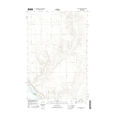
2014 Map of Turtle Creek SW
USGS Topo · Published 2014About this map
The Missouri River forms the southwestern boundary of this landscape where the high plains of McLean County meet Oliver County. The terrain is defined by the winding course of Turtle Cr, which carves a path through the rolling contours as it heads toward the Missouri valley. This 2014 survey documents a mix of rural infrastructure and residential pockets, particularly in the southwest near the river where developments like Eagle Hts and roads such as Skyline Dr and Riverside Ln are established. To the east, the drainage of Painted Woods Cr feeds into Lost Lake, illustrating the hydrological patterns of the Missouri River bottomlands. The map reveals a strict section-line road grid, including 4th St SW and 20th Ave SW, typical of the central North Dakota agricultural landscape.
Find a feature on this map
21 named features on this map. Tap any name to fly to it.
Don’t see what you’re looking for? This feature index may not catch every label — zoom into the map to look around manually.
Map Details
Editions of this 2014 Turtle Creek SW Map
This is the sole edition of this map. No revisions or reprints were ever made.
Other maps of this area

1949 · Turtle Creek
USGS Topo · 1:62,500

1949 · Washburn
USGS Topo · 1:62,500

1950 · Wilton
USGS Topo · 1:62,500

1954 · McClusky
USGS Topo · 1:250,000

1958 · McClusky
USGS Topo · 1:250,000

1961 · Turtle Creek SW
USGS Topo · 1:24,000

1961 · Washburn
USGS Topo · 1:24,000

1961 · Turtle Creek NE
USGS Topo · 1:24,000

1961 · Washburn NE
USGS Topo · 1:24,000

1961 · Turtle Creek NW
USGS Topo · 1:24,000