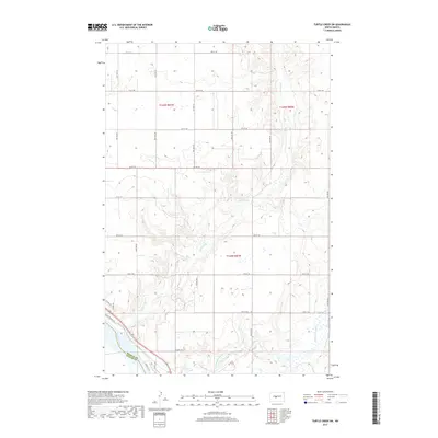
2017 Map of Turtle Creek SW
USGS Topo · Published 2017About this map
Missouri River currents define the southwestern corner of this landscape, marking the boundary between McLean and Oliver Counties. The terrain is characterized by the winding drainage of Turtle Creek, which carves through the central portion of the quadrangle before approaching the river valley. The map documents a predominantly rural section of North Dakota, where the Public Land Survey System grid is clearly visible through township markers like t144n r81w and a network of section-line roads.
Find a feature on this map
23 named features on this map. Tap any name to fly to it.
Don’t see what you’re looking for? This feature index may not catch every label — zoom into the map to look around manually.
Map Details
Editions of this 2017 Turtle Creek SW Map
This is the sole edition of this map. No revisions or reprints were ever made.
Other maps of this area

1949 · Turtle Creek
USGS Topo · 1:62,500

1949 · Washburn
USGS Topo · 1:62,500

1950 · Wilton
USGS Topo · 1:62,500

1954 · McClusky
USGS Topo · 1:250,000

1958 · McClusky
USGS Topo · 1:250,000

1961 · Turtle Creek SW
USGS Topo · 1:24,000

1961 · Washburn
USGS Topo · 1:24,000

1961 · Turtle Creek NE
USGS Topo · 1:24,000

1961 · Washburn NE
USGS Topo · 1:24,000

1961 · Turtle Creek NW
USGS Topo · 1:24,000