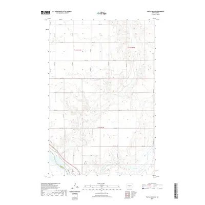
2020 Map of Turtle Creek SW
USGS Topo · Published 2020About this map
The Missouri River forms a significant geographical boundary in the southwestern corner of this survey, where the border between McLean and Oliver Counties follows the channel. The landscape is defined by the winding course of Turtle Cr, which meanders through the central and northern sections, and Painted Woods Creek to the southeast. These watercourses have carved distinct drainage patterns into the terrain, creating a network of coulees and ridges that contrast with the more level sections of the plateau above.
Find a feature on this map
22 named features on this map. Tap any name to fly to it.
Don’t see what you’re looking for? This feature index may not catch every label — zoom into the map to look around manually.
Map Details
Editions of this 2020 Turtle Creek SW Map
This is the sole edition of this map. No revisions or reprints were ever made.
Other maps of this area

1949 · Turtle Creek
USGS Topo · 1:62,500

1949 · Washburn
USGS Topo · 1:62,500

1950 · Wilton
USGS Topo · 1:62,500

1954 · McClusky
USGS Topo · 1:250,000

1958 · McClusky
USGS Topo · 1:250,000

1961 · Turtle Creek SW
USGS Topo · 1:24,000

1961 · Washburn
USGS Topo · 1:24,000

1961 · Turtle Creek NE
USGS Topo · 1:24,000

1961 · Washburn NE
USGS Topo · 1:24,000

1961 · Turtle Creek NW
USGS Topo · 1:24,000