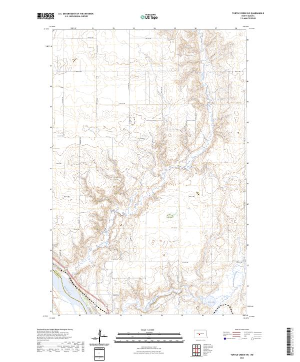
2024 Map of Turtle Creek SW
USGS Topo · Published 2024About this map
The Missouri River cuts across the southwestern corner of this McLean County landscape, creating a distinct boundary between the river valley and the undulating uplands. This area is defined by significant conservation tracts, including the McLean County Waterfowl Production Area and the Lost Lake National Wildlife Refuge at the southern edge. The hydrological network is dominated by the winding path of Turtle Creek, which meanders through the central sections of the quadrangle, and Painted Woods Creek to the south near Lost Lake. Residential and recreational access is concentrated near the river, evidenced by Skyline Dr and Riverside Ln, while the rugged riverbanks are accessible via the Cross Ranch Trails Trl. The survey reflects a sparsely populated agricultural and conservation-focused region where section lines like 20th Ave SW and 4th St SW provide the primary infrastructure.
Find a feature on this map
33 named features on this map. Tap any name to fly to it.
Don’t see what you’re looking for? This feature index may not catch every label — zoom into the map to look around manually.
Map Details
Editions of this 2024 Turtle Creek SW Map
This is the sole edition of this map. No revisions or reprints were ever made.
Other maps of this area

1949 · Turtle Creek
USGS Topo · 1:62,500

1949 · Washburn
USGS Topo · 1:62,500

1950 · Wilton
USGS Topo · 1:62,500

1954 · McClusky
USGS Topo · 1:250,000

1958 · McClusky
USGS Topo · 1:250,000

1961 · Turtle Creek SW
USGS Topo · 1:24,000

1961 · Washburn
USGS Topo · 1:24,000

1961 · Turtle Creek NE
USGS Topo · 1:24,000

1961 · Washburn NE
USGS Topo · 1:24,000

1961 · Turtle Creek NW
USGS Topo · 1:24,000