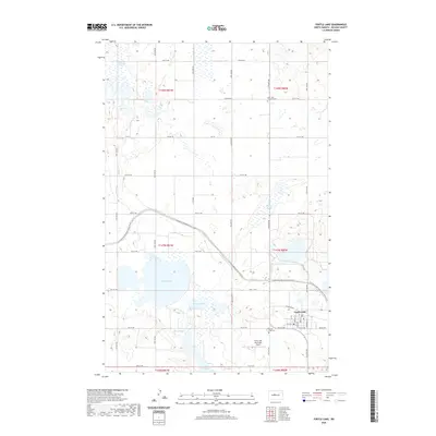
2020 Map of Turtle Lake
USGS Topo · Published 2020About this map
Turtle Lake and its namesake town serve as the primary focus in this McLean County landscape, where the prairie is defined by a dense network of glacial sloughs and lakes. The central settlement of Turtle Lake is organized around a grid of streets including Railroad Ave and Burke Ave, supported by the Turtle Lake Municipal Airport to the south. This era shows the modern path of the N Country National Scenic Trail as it winds through the center of the quadrangle, skirting several large water bodies like Lake Brekken and Kasper Slough. For those researching local heritage, the map identifies key burial sites such as Saint Olaf Lutheran Cem to the north and the Turtle Lake Cem near the town center, while hydrological features like Brittons Slough and Mud Lake reflect the characteristic wetland geography of the Missouri Plateau.
Find a feature on this map
34 named features on this map. Tap any name to fly to it.
Don’t see what you’re looking for? This feature index may not catch every label — zoom into the map to look around manually.
Map Details
Editions of this 2020 Turtle Lake Map
This is the sole edition of this map. No revisions or reprints were ever made.
Other maps of this area

1929 · Coleharbor
USGS Topo · 1:62,500

1947 · Turtle Lake
USGS Topo · 1:62,500

1949 · Turtle Creek
USGS Topo · 1:62,500

1949 · Washburn
USGS Topo · 1:62,500

1954 · McClusky
USGS Topo · 1:250,000

1958 · McClusky
USGS Topo · 1:250,000

1961 · Turtle Lake
USGS Topo · 1:24,000

1961 · Lake Nettie
USGS Topo · 1:24,000

1961 · Turtle Creek NE
USGS Topo · 1:24,000

1961 · Washburn NE
USGS Topo · 1:24,000